ALMAGUIN COMMUNITY MAPS

From Callander in the north to Novar in the south, any of these picturesque communities in and around the Almaguin Highlands can provide you with an excellent starting point to explore the region,
irregardless of the season.

formerly Jarlsberg, in the old township of Monteith, is a quiet community originally colonized by Scandinavian settlers in the late 1860's.

The Village of Burks Falls Ontario along with the adjoining municipalities of the Township of Ryerson and the Township of Armour can be summed up in four words... "A playground of adventure".

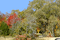
The adjoining Townships of Nipissing & Callander in Ontario, offers visitors an opportunity to relax and enjoy the beauty of the area.

A visit to the Highlands would not be complete without dropping by the Commanda Store Museum and checking out the history of the area.

Fifty kilometers out of Parry Sound the rudimentary wagon road crossed the narrows that separated the two main bodies of Whitestone Lake. (named for a curious outcropping of snow-white crystalline
limestone or marble at that location).

Emsdale Ontario and the nearby community of Novar boasts one the Highlands and Ontario's greatest natural attractions; Brooks Falls is perhaps the greatest example of an untouched
wilderness waterfall undisturbed by modern development
and it is easily accessible.

Katrine Ontario is a quaint hamlet positioned at the North end of Doe Lake and located on Hwy. 11.
Visitors to Katrine will enjoy the scenic picnic area at the public beach in addition to the rest area located on the northern tip of Doe Lake.

This "Biggest Little Town" is world renowned for the Kearney Winter Fest Dog Sled Derby. There are also three close access points into Algonquin Park for your convenience.
Visitors to this area enjoy camping and fishing at many of the available resorts, cottages and campgrounds.

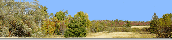
The area itself is sprinkled with a wealth of fresh water lakes and awe-inspiring countryside offering excellent hunting and fishing.

Magnetawan is an historical village located between Lake Cecebe & Ahmic Lake on the beautiful Magnetawan River.

Novar is the southern most community in the Almaguin Highlands and hosts a convenient shopping plaza for all your needs when traveling north to visit the Highlands.

Nipissing is a small communtiy just north of the junction of Hwy 534 and Hwy 654 in the township of Nipissing Ontario

" The Friendly Town". An Ojibway word meaning "bend in the river". Settlers established this community well over a century ago, and it has prospered ever since.

Lake Restoule in Restoule Provincial Park is the gateway to the French River system and offers exciting camping, fishing, boating and canoeing.

Many people have described South River as "A friendly community surrounded with natural beauty".

With excellent trails, this part of Ontario is a major destination for snowmobilers in the winter and ATV's from April til November.

The Village of Sundridge Ontario surrounded by the Townships of "Strong" and "Joly" together offer an irresistible package that appeals to people of all ages.

Located on Highway 11 just south of Powassan, Trout Creek is the future home of the new Observatory being planned for the Highlands.
ALMAGUIN TOWNSHIPS

Featured on this map is the outline of the townships as you pass your mouse over the different areas.

Almaguin Web Services Site
Map

Almaguin Web Services - © 2003-2023 - All rights reserved
|